Geolocate

Rogers topographic map

Click on the map to display elevation.

About this map

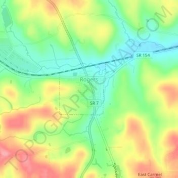
Name: Rogers topographic map, elevation, terrain.

Location: Rogers, Columbiana County, Ohio, United States (40.78600 -80.63209 40.79397 -80.62286)

Average elevation: 339 m

Minimum elevation: 295 m

Maximum elevation: 391 m

Other topographic maps

Click on a map to view its topography, its elevation and its terrain.

Reading

United States > Ohio > Columbiana County

Average elevation: 365 m

Homeworth

United States > Ohio > Columbiana County

Average elevation: 369 m

Westville

United States > Ohio > Columbiana County

Average elevation: 344 m

Vulcan

United States > Ohio > Columbiana County > Wellsville

Average elevation: 282 m

East Rochester

United States > Ohio > Columbiana County

Average elevation: 356 m

Kensington

United States > Ohio > Columbiana County

Average elevation: 365 m

Gear up for your next adventure:

🥾Waterproof Trail Shoes - Shoes designed to handle wet terrain
🔭Outdoor Binoculars - Lightweight binoculars for birdwatching and hiking
🚲MTB Frame Bag - Carry tools and maps directly on your bicycle frame
💡LED Headlamp - Hands-free illumination for night hiking and camping
🧥Packable Rain Jacket - Breathable waterproof layer for unpredictable weather

As an Amazon Associate, this site earns from qualifying purchases at no extra cost to you.