Geolocate

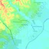
Kandis topographic map

Click on the map to display elevation.

About this map

Name: Kandis topographic map, elevation, terrain.

Location: Kandis, Siak, Riau, 28686, Indonesia (0.79744 100.90687 1.24848 101.48324)

Average elevation: 25 m

Minimum elevation: 3 m

Maximum elevation: 101 m

Other topographic maps

Click on a map to view its topography, its elevation and its terrain.
Perawang

Indonesia > Riau > Siak

Average elevation: 10 m

Perawang

Indonesia > Riau > Siak

Average elevation: 10 m

Siak Sri Indrapura

Indonesia > Riau > Siak

Average elevation: 5 m

Perawang

Indonesia > Riau > Siak

Average elevation: 12 m

Minas Barat

Indonesia > Riau > Siak

Average elevation: 64 m

Minas Jaya

Indonesia > Riau > Siak

Average elevation: 68 m

Maredan

Indonesia > Riau > Siak

Average elevation: 7 m

Gear up for your next adventure:

🧭GPS Outdoor Watch - Smart watch for navigation and fitness tracking in nature
⛺Camping Essentials - All-in-one gear for a comfortable camping trip
🛌Insulated Sleeping Pad - Critical thermal barrier between you and the cold ground
🔦LED Headlamp - Hands-free lighting for early morning starts or late finishes
🩹Compact First Aid Kit - Pre-packed essentials for common trail injuries

As an Amazon Associate, this site earns from qualifying purchases at no extra cost to you.