Geolocate

Shabramant topographic map

Click on the map to display elevation.

About this map

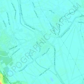
Name: Shabramant topographic map, elevation, terrain.

Location: Shabramant, Giza, 12947, Egypt (29.92077 31.17012 29.96077 31.21012)

Average elevation: 20 m

Minimum elevation: 14 m

Maximum elevation: 55 m

Other topographic maps

Click on a map to view its topography, its elevation and its terrain.

Giza Pyramids

Egypt > Giza > Giza

Average elevation: 65 m

Giza Pyramids

Egypt > Giza > Giza

Average elevation: 65 m

Giza Pyramids

Egypt > Giza > Giza

Average elevation: 65 m

Al Haraneya Village

Egypt > Giza

Average elevation: 19 m

Ard Al Lwaa'

Egypt > Giza > Nazlet Bahgat

Average elevation: 23 m

Kerdasa City

Egypt > Giza > Kirdasah

Average elevation: 28 m

Abo Al Nomros City

Egypt > Giza > Abu An Numrus

Average elevation: 20 m

Sheikh Zayed

Egypt > Giza

Average elevation: 122 m

City View

Egypt > Giza

Average elevation: 65 m

Al Mounib

Egypt > Giza

Average elevation: 22 m

Jazirat Warraq al Hadar

Egypt > Giza > Tanaash

Average elevation: 20 m

Ard Al Lwaa'

Egypt > Giza > Nazlet Bahgat

Average elevation: 23 m

Gezirat Dahab

Egypt > Giza

Average elevation: 21 m

Qursaya

Egypt > Giza > Giza

Average elevation: 23 m

Abu Sir

Egypt > Giza > Abu Sir

Average elevation: 44 m

El Hassana Dome Protectorate

Egypt > Giza > Sheikh Zayed

Average elevation: 108 m

Gear up for your next adventure:

🧥Waterproof Jacket - Lightweight rain jackets for hiking and outdoor activities
🥾Waterproof Hiking Boots - Essential footwear for rugged terrain and wet Canadian trails
🥾Hiking Boots - Sturdy boots providing ankle support and traction on rugged trails
🛶Canoe Life Vest - Safety vest for water sports
🧢Hiking Hat - Sun-protective and breathable hats for long treks

As an Amazon Associate, this site earns from qualifying purchases at no extra cost to you.