Geolocate

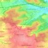
91522 topographic map

Click on the map to display elevation.

About this map

Name: 91522 topographic map, elevation, terrain.

Location: 91522, Ansbach, Bayern, Deutschland (49.23396 10.45430 49.34377 10.65631)

Average elevation: 451 m

Minimum elevation: 362 m

Maximum elevation: 518 m

Other topographic maps

Click on a map to view its topography, its elevation and its terrain.

Ansbach

Deutschland > Bayern > Ansbach

In Ansbach startet der Europäische Wasserscheideweg, der entlang der europäischen Hauptwasserscheide über die Frankenhöhe in 5 Etappen nach Schnelldorf führt. Hier endet der Fernwanderweg Ansbacher Weg aus Burgfarrnbach des Fränkischen Albverein.

Average elevation: 448 m

Brodswinden

Deutschland > Bayern > Ansbach

Average elevation: 457 m

Geisengrund

Deutschland > Bayern > Ansbach

Average elevation: 461 m

Gösseldorf

Deutschland > Bayern > Ansbach

Average elevation: 462 m

Winterschneidbach

Deutschland > Bayern > Ansbach

Average elevation: 465 m

Brodswinden

Deutschland > Bayern > Ansbach

Average elevation: 457 m

Gear up for your next adventure:

🧦Outdoor Socks - Durable socks designed for hiking and outdoor sports
🔦LED Headtorch - Bright and durable light for night activities
🧦Thermal Socks - Warm socks for winter hiking or camping
🪜Heavy Duty Carabiners - Multi-use clips for securing gear to your backpack
🥾Trail Hiking Socks - Comfortable socks to prevent blisters and fatigue

As an Amazon Associate, this site earns from qualifying purchases at no extra cost to you.