
Ansbach topographic map
Click on the map to display elevation.
Ansbach
In Ansbach startet der Europäische Wasserscheideweg, der entlang der europäischen Hauptwasserscheide über die Frankenhöhe in 5 Etappen nach Schnelldorf führt. Hier endet der Fernwanderweg Ansbacher Weg aus Burgfarrnbach des Fränkischen Albverein.
About this map
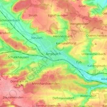
Name: Ansbach topographic map, elevation, terrain.
Location: Ansbach, Bayern, 91522, Deutschland (49.26286 10.53223 49.34286 10.61223)
Average elevation: 448 m
Minimum elevation: 392 m
Maximum elevation: 504 m