Geolocate

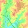
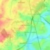
Rowington topographic map

Click on the map to display elevation.

About this map

Name: Rowington topographic map, elevation, terrain.

Location: Rowington, Warwick, Warwickshire, England, United Kingdom (52.28278 -1.74189 52.33775 -1.67533)

Average elevation: 110 m

Minimum elevation: 73 m

Maximum elevation: 140 m

Other topographic maps

Click on a map to view its topography, its elevation and its terrain.

Pinley Green

United Kingdom > England > Warwickshire > Warwick > Rowington

Average elevation: 110 m

Haseley Knob

United Kingdom > England > Warwickshire > Warwick > Wroxall

Average elevation: 117 m

Leek Wootton

United Kingdom > England > Warwickshire > Warwick

Average elevation: 76 m

Catchem's End

United Kingdom > England > Warwickshire > Warwick > Hatton

Average elevation: 98 m

Gear up for your next adventure:

🥾Waterproof Hiking Boots - Essential footwear for rugged terrain and wet Canadian trails
🧰Survival Kit - Essential gear for emergencies in the wilderness
🛏️Camping Sleeping Mat - Comfortable mats for sleeping outdoors
🦟Insect Repellent - Keep mosquitoes and black flies away in wooded areas
⛺Camping Essentials - All-in-one gear for a comfortable camping trip

As an Amazon Associate, this site earns from qualifying purchases at no extra cost to you.