Geolocate

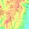
Wroxall topographic maps

Click on a map to view its topography, its elevation and its terrain.

Haseley Knob

United Kingdom > England > Warwickshire > Warwick > Wroxall

Average elevation: 117 m

Gear up for your next adventure:

🧢Outdoor Cap - Protective cap for sun and rain during hikes
🧊Insulated Water Bottle - Keeps drinks cold in summer and prevents freezing in winter
🌬️Windproof Camp Stove - Efficient cooking even on exposed mountain peaks
🧢Beanie Hat - Keep your head warm in cold weather
🏃Hydration Running Vest - Carry water and maps close to your body for speed

As an Amazon Associate, this site earns from qualifying purchases at no extra cost to you.