
Hindu Raj topographic map
Interactive map
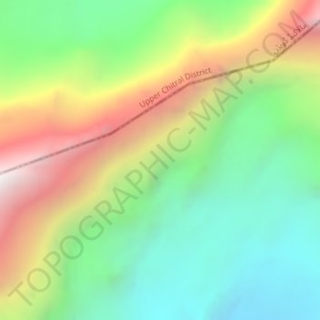
Click on the map to display elevation.
About this map
Name: Hindu Raj topographic map, elevation, terrain.
Location: Hindu Raj, Gilgit District, Gilgit-Baltistan, Pakistan (36.69995 73.14495 36.70005 73.14505)
Average elevation: 5,118 m
Minimum elevation: 4,504 m
Maximum elevation: 6,090 m
Other topographic maps
Click on a map to view its topography, its elevation and its terrain.
Kharfaq
Kharfaq, Ghanche District, Gilgit-Baltistan, Pakistan
Average elevation: 2,917 m
Karakoram
Karakoram, Baltistān District, Gilgit-Baltistan, Pakistan
Average elevation: 4,414 m
K2
K2, ABC to Camp 1, Shigar District, Gilgit-Baltistan, Pakistan
Average elevation: 7,490 m
Khunjerab Pass
Khunjerab Pass, Gilgit-Baltistan, Pakistan
Average elevation: 4,771 m
Skardu
Pakistan > Gilgit-Baltistan > Skardu
Skardu, Gilgit-Baltistan, BALTISTAN, Pakistan
Average elevation: 3,486 m
Askole
Pakistan > Gilgit-Baltistan > Askole
Askole, Gilgit-Baltistan, Pakistan
Average elevation: 3,360 m
Biafo Glacier
Biafo Glacier, Gilgit-Baltistan, Pakistan
Average elevation: 4,651 m
Kashmir
Kashmir, Baltistān District, Gilgit-Baltistan, Pakistan
Average elevation: 3,714 m
Khyber
Pakistan > Gilgit-Baltistan > Khyber
Khyber, Gilgit District, Gilgit-Baltistan, Pakistan
Average elevation: 3,202 m
Khunjerāb River
Khunjerāb River, Gilgit-Baltistan, Pakistan
Average elevation: 4,882 m
Vigne Glacier
Vigne Glacier, Baltistān District, Gilgit-Baltistan, Pakistan
Average elevation: 5,428 m
Gasherbrum IV
Gasherbrum IV, Baltistān District, Gilgit-Baltistan, Pakistan
Average elevation: 6,806 m
Diran
Pakistan > Gilgit-Baltistan > Gilgit
Diran, Gilgit, Gilgit District, Gilgit-Baltistan, Pakistan
Average elevation: 6,311 m
Panmah Glacier
Panmah Glacier, Baltistān District, Gilgit-Baltistan, Pakistan
Average elevation: 4,966 m
Malubiting
Malubiting, Gilgit District, Gilgit-Baltistan, Pakistan
Average elevation: 6,584 m
Trango Glacier
Trango Glacier, Baltistān District, Gilgit-Baltistan, Pakistan
Average elevation: 5,284 m
Sangemarmur
Sangemarmur, Gilgit District, Gilgit-Baltistan, Pakistan
Average elevation: 5,955 m
Kunyang Chhish
Kunyang Chhish, Gilgit District, Gilgit-Baltistan, Pakistan
Average elevation: 6,837 m
Batura Glacier
Batura Glacier, Gilgit District, Gilgit-Baltistan, Pakistan
Average elevation: 4,775 m
Haramosh
Haramosh, Diāmir District, Gilgit-Baltistan, Pakistan
Average elevation: 6,476 m
Baltoro Glacier
Baltoro Glacier, Baltistān District, Gilgit-Baltistan, Pakistan
Average elevation: 5,349 m
Kanjut Sar I
Kanjut Sar I, Baltistān District, Gilgit-Baltistan, Pakistan
Average elevation: 6,762 m
Gasherbrum I
Gasherbrum I, Baltistān District, Gilgit-Baltistan, Pakistan
Average elevation: 7,177 m
Rakaposhi
Pakistan > Gilgit-Baltistan > Gilgit
Rakaposhi, Gilgit, Gilgit District, Gilgit-Baltistan, Pakistan
Average elevation: 6,882 m
Gasherbrum V
Gasherbrum V, Baltistān District, Gilgit-Baltistan, Pakistan
Average elevation: 6,267 m
Masherbrum
Masherbrum, Baltistān District, Gilgit-Baltistan, Pakistan
Average elevation: 6,469 m
Laila Peak
Laila Peak, Baltistān District, Gilgit-Baltistan, Pakistan
Average elevation: 5,066 m
Muztagh Tower
Muztagh Tower, Baltistān District, Gilgit-Baltistan, Pakistan
Average elevation: 5,972 m
Gilgit
Pakistan > Gilgit-Baltistan > Gilgit
Gilgit, Gilgit District, Gilgit-Baltistan, Pakistan
Average elevation: 3,002 m
Miar Glacier
Miar Glacier, Gilgit District, Gilgit-Baltistan, Pakistan
Average elevation: 4,320 m
Nanga Parbat
Nanga Parbat, Astore, Gilgit-Baltistan, Pakistan
Average elevation: 7,086 m
Saltoro Kangri
Saltoro Kangri, Baltistān District, Gilgit-Baltistan, Pakistan
Average elevation: 6,652 m