Geolocate

Kharfaq topographic map

Click on the map to display elevation.

About this map

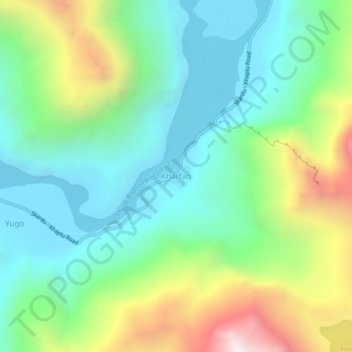
Name: Kharfaq topographic map, elevation, terrain.

Location: Kharfaq, Ghanche District, Gilgit-Baltistan, Pakistan (35.17056 76.16165 35.21056 76.20165)

Average elevation: 2,917 m

Minimum elevation: 2,432 m

Maximum elevation: 4,004 m

Other topographic maps

Click on a map to view its topography, its elevation and its terrain.

Hunza District

Pakistan > Gilgit-Baltistan

Average elevation: 4,510 m

Karakoram

Pakistan > Gilgit-Baltistan

Average elevation: 4,414 m

Gear up for your next adventure:

🧢Beanie Hat - Keep your head warm in cold weather
🔦LED Headtorch - Bright and durable light for night activities
🥾Trail Running Boots - Durable shoes designed for trail running
Backpacking Tent - Lightweight tent for long-distance hiking trips
🚑Survival Whistle - Signal for help across long distances in mountains

As an Amazon Associate, this site earns from qualifying purchases at no extra cost to you.