Geolocate

Valley topographic map

Click on the map to display elevation.

About this map

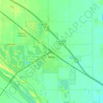
Name: Valley topographic map, elevation, terrain.

Location: Valley, Douglas County, Nebraska, 68064, United States (41.29173 -96.39624 41.34070 -96.30951)

Average elevation: 347 m

Minimum elevation: 340 m

Maximum elevation: 358 m

Other topographic maps

Click on a map to view its topography, its elevation and its terrain.

Venice

United States > Nebraska > Douglas County

Average elevation: 345 m

King Lake

United States > Nebraska > Douglas County > King Lake

Average elevation: 345 m

Omaha

United States > Nebraska > Douglas County > Omaha

Average elevation: 339 m

Devil's Slide

United States > Nebraska > Douglas County > Omaha

Average elevation: 324 m

Irvington

United States > Nebraska > Douglas County > Omaha

Average elevation: 355 m

Memorial Park

United States > Nebraska > Douglas County > Omaha

Average elevation: 354 m

Gear up for your next adventure:

🥾Waterproof Hiking Boots - Essential footwear for rugged terrain and wet Canadian trails
🐕Hiking Dog Pack - Let your canine companion carry their own water and food
🧦Merino Wool Socks - Moisture-wicking comfort for long-distance hiking
🥫Freeze-Dried Meals - Lightweight, high-calorie nutrition for multi-day treks
💡Portable Camping Lamp - Rechargeable lamp for campsite lighting

As an Amazon Associate, this site earns from qualifying purchases at no extra cost to you.