Geolocate

Laguna Seca topographic map

Click on the map to display elevation.

About this map

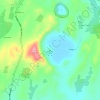
Name: Laguna Seca topographic map, elevation, terrain.

Location: Laguna Seca, La Paz Centro, León, 22100, Nicaragua (12.37709 -86.65416 12.37719 -86.65406)

Average elevation: 120 m

Minimum elevation: 70 m

Maximum elevation: 215 m

Other topographic maps

Click on a map to view its topography, its elevation and its terrain.

El Picacho

Nicaragua > Leon > Santa Rosa del Peñón

Average elevation: 527 m

Poneloya

Nicaragua > Leon > León

Average elevation: 4 m

Nagarote

Nicaragua > Leon

Average elevation: 62 m

Las Cruces

Nicaragua > Leon

Average elevation: 786 m

El Sauce

Nicaragua > Leon

Average elevation: 320 m

El Sauce

Nicaragua > Leon

Average elevation: 170 m

León

Nicaragua > Leon

Average elevation: 61 m

León (Municipio)

Nicaragua > Leon

Average elevation: 61 m

Gear up for your next adventure:

🧦Crew Hiking Socks - Comfortable socks for long-distance hikes
🧥Waterproof Hiking Jacket - Protect yourself from rain and wind while hiking
💧Reusable Water Bottle - Durable water bottles for hydration on trails
🕶️Polarized Sunglasses - Reduces glare from snow and water at high elevations
🥾Trail Hiking Boots - Supportive boots for rough trails

As an Amazon Associate, this site earns from qualifying purchases at no extra cost to you.