Geolocate

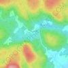
Lac Mondor topographic map

Click on the map to display elevation.

About this map

Name: Lac Mondor topographic map, elevation, terrain.

Location: Lac Mondor, Shawinigan, Mauricie, Québec, Canada (46.62403 -72.77379 46.62671 -72.76367)

Average elevation: 186 m

Minimum elevation: 140 m

Maximum elevation: 332 m

Other topographic maps

Click on a map to view its topography, its elevation and its terrain.

Lac Wapizagonke

Canada > Québec > Shawinigan

D'une longueur de 15 km, le lac Wapizagonke est situé à l'extrémité ouest du parc national de la Mauricie, au nord de Shawinigan, dans le canton de Désaulniers. Ce lac est d'une forme étroite et tout en longueur dans l'axe nord-sud. Son embouchure se déverse par son extrémité sud dans la rivière…

Average elevation: 335 m

Lac-des-Piles

Canada > Québec > Shawinigan

Average elevation: 208 m

Lac Tessier

Canada > Québec > Shawinigan

Average elevation: 378 m

Baie des Onze Îles

Canada > Québec > Shawinigan

Average elevation: 383 m

Saint-Jean-des-Piles

Canada > Québec > Shawinigan

Average elevation: 168 m

Lac Lamarre

Canada > Québec > Shawinigan

Average elevation: 209 m

Lac des Neiges

Canada > Québec > Shawinigan

Average elevation: 180 m

Lac Bonin

Canada > Québec > Shawinigan

Average elevation: 294 m

Lac Français

Canada > Québec > Shawinigan

Average elevation: 230 m

Gear up for your next adventure:

🥤Collapsible Travel Cup - Saves space and weight in your mess kit
⛺Camping Groundsheet - Protect your tent from moisture and dirt
🦶Anti-Blister Balm - Prevents friction and hotspots during long ascents
💧Reusable Water Bottle - Durable water bottles for hydration on trails
🧦Outdoor Socks - Durable socks designed for hiking and outdoor sports

As an Amazon Associate, this site earns from qualifying purchases at no extra cost to you.