Geolocate

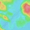
Lac Tessier topographic map

Click on the map to display elevation.

About this map

Name: Lac Tessier topographic map, elevation, terrain.

Location: Lac Tessier, Shawinigan, Mauricie, Québec, Canada (46.74998 -73.15534 46.75631 -73.13958)

Average elevation: 378 m

Minimum elevation: 291 m

Maximum elevation: 447 m

Other topographic maps

Click on a map to view its topography, its elevation and its terrain.

Lac-des-Piles

Canada > Québec > Shawinigan

Average elevation: 208 m

Lac Mondor

Canada > Québec > Shawinigan

Average elevation: 186 m

Baie des Onze Îles

Canada > Québec > Shawinigan

Average elevation: 383 m

Saint-Jean-des-Piles

Canada > Québec > Shawinigan

Average elevation: 168 m

Lac Grenier

Canada > Québec > Shawinigan

Average elevation: 275 m

Rivière Saint-Maurice

Canada > Québec > Shawinigan

Average elevation: 86 m

Gear up for your next adventure:

🧤Rechargeable Heated Gloves - Extreme warmth for Canadian winter expeditions
⛺Tent Footprint - Protect tent floor and increase durability
🔭Compact Binoculars - Lightweight optics for scouting trails and wildlife
🎒Hiking Daypack - Lightweight and durable backpacks for day trips and excursions
🥘Camping Cookware Set - Compact nesting pots and pans for trail cooking

As an Amazon Associate, this site earns from qualifying purchases at no extra cost to you.