Geolocate

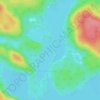
Lac des Neiges topographic map

Click on the map to display elevation.

About this map

Name: Lac des Neiges topographic map, elevation, terrain.

Location: Lac des Neiges, Shawinigan, Mauricie, Québec, Canada (46.61628 -72.78076 46.62067 -72.77042)

Average elevation: 180 m

Minimum elevation: 136 m

Maximum elevation: 344 m

Other topographic maps

Click on a map to view its topography, its elevation and its terrain.

Saint-Jean-des-Piles

Canada > Québec > Shawinigan

Average elevation: 168 m

Lac-des-Piles

Canada > Québec > Shawinigan

Average elevation: 208 m

Lac Mondor

Canada > Québec > Shawinigan

Average elevation: 186 m

Baie des Onze Îles

Canada > Québec > Shawinigan

Average elevation: 383 m

Lac Grenier

Canada > Québec > Shawinigan

Average elevation: 275 m

Rivière Saint-Maurice

Canada > Québec > Shawinigan

Average elevation: 86 m

Gear up for your next adventure:

🥫Freeze-Dried Meals - Lightweight, high-calorie nutrition for multi-day treks
🌬️Windproof Camp Stove - Efficient cooking even on exposed mountain peaks
🧥Softshell Hiking Jacket - The perfect balance of wind protection and breathability
🥾Lightweight Hiking Shoes - Comfortable shoes for day hikes
💧Hydration Pack - Hands-free hydration system for long hikes

As an Amazon Associate, this site earns from qualifying purchases at no extra cost to you.