
Radelange topographic map
Interactive map
Click on the map to display elevation.
About this map
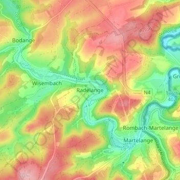
Name: Radelange topographic map, elevation, terrain.
Location: Radelange, Martelange, Aarlen, Luxemburg, Wallonië, 6630, België (49.82252 5.70096 49.86252 5.74096)
Average elevation: 424 m
Minimum elevation: 348 m
Maximum elevation: 498 m
Other topographic maps
Click on a map to view its topography, its elevation and its terrain.