
Aubange topographic map
Interactive map
Click on the map to display elevation.
About this map
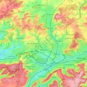
Name: Aubange topographic map, elevation, terrain.
Location: Aubange, Aarlen, Luxemburg, Wallonië, België (49.53880 5.70364 49.61176 5.87326)
Average elevation: 324 m
Minimum elevation: 247 m
Maximum elevation: 422 m
Other topographic maps
Click on a map to view its topography, its elevation and its terrain.