Geolocate

Bahong topographic map

Click on the map to display elevation.

About this map

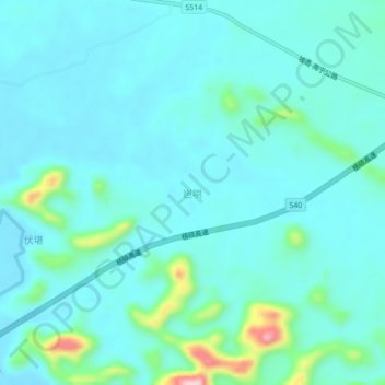
Name: Bahong topographic map, elevation, terrain.

Location: Bahong, Nanning, Guangxi, China (23.20120 108.06400 23.24120 108.10400)

Average elevation: 129 m

Minimum elevation: 98 m

Maximum elevation: 300 m

Other topographic maps

Click on a map to view its topography, its elevation and its terrain.

Qingxiu District

China > Guangxi > Nanning

Average elevation: 140 m

Long'an County

China > Guangxi > Nanning

Average elevation: 255 m

Xingning District

China > Guangxi > Nanning

Average elevation: 191 m

Liangqing

China > Guangxi > Nanning

Average elevation: 98 m

Yongning District

China > Guangxi > Nanning

Average elevation: 118 m

Heng County

China > Guangxi > Nanning

Average elevation: 135 m

Gear up for your next adventure:

🧊Insulated Water Bottle - Keeps drinks cold in summer and prevents freezing in winter
Camping Groundsheet - Protect your tent from moisture and dirt
🧶550 Survival Paracord - Versatile utility cord for emergency repairs and rigging
🧢Hiking Hat - Sun-protective and breathable hats for long treks
🧴Bear Spray Holster - Quick-access carry for essential Canadian wilderness safety

As an Amazon Associate, this site earns from qualifying purchases at no extra cost to you.