Geolocate

Bannockburn topographic map

Click on the map to display elevation.

About this map

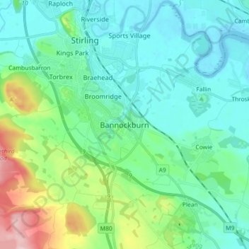
Name: Bannockburn topographic map, elevation, terrain.

Location: Bannockburn, Stirling, Scotland, FK7 8LZ, United Kingdom (56.05089 -3.95323 56.13089 -3.87323)

Average elevation: 51 m

Minimum elevation: -1 m

Maximum elevation: 237 m

Other topographic maps

Click on a map to view its topography, its elevation and its terrain.

Abbey Craig

United Kingdom > Scotland > Stirling > Stirling

Average elevation: 16 m

Gear up for your next adventure:

🧢Beanie Hat - Keep your head warm in cold weather
🚲Heavy Duty Bike Lock - Secure your bike at the trailhead or during stops
🧥Thermal Layer - Insulating layer for cold outdoor conditions
🦌Outdoor Trail Camera - Monitor wildlife activity near your favorite spots
🥤Collapsible Travel Cup - Saves space and weight in your mess kit

As an Amazon Associate, this site earns from qualifying purchases at no extra cost to you.