Geolocate

Shattuc topographic map

Click on the map to display elevation.

About this map

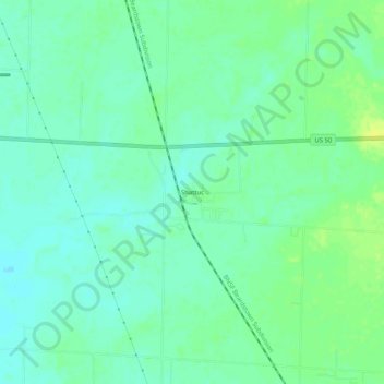
Name: Shattuc topographic map, elevation, terrain.

Location: Shattuc, Clinton County, Illinois, United States (38.59060 -89.21285 38.63060 -89.17285)

Average elevation: 146 m

Minimum elevation: 138 m

Maximum elevation: 157 m

Other topographic maps

Click on a map to view its topography, its elevation and its terrain.

Damiansville

United States > Illinois > Clinton County

Average elevation: 130 m

New Baden

United States > Illinois > Clinton County

Average elevation: 141 m

Beckemeyer

United States > Illinois > Clinton County

Average elevation: 137 m

Carlyle

United States > Illinois > Clinton County

Average elevation: 140 m

Albers

United States > Illinois > Clinton County

Average elevation: 131 m

Germantown

United States > Illinois > Clinton County

Average elevation: 132 m

Gear up for your next adventure:

🧴Outdoor Sunscreen - High SPF protection for high-altitude UV exposure
🚑Survival Whistle - Signal for help across long distances in mountains
🥾Hiking Shorts - Breathable shorts suitable for summer hikes
🛶Waterproof Dry Bags - Keep electronics and clothes dry during river crossings
🔭Compact Binoculars - Lightweight optics for scouting trails and wildlife

As an Amazon Associate, this site earns from qualifying purchases at no extra cost to you.