Geolocate

Carlyle topographic map

Click on the map to display elevation.

About this map

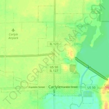
Name: Carlyle topographic map, elevation, terrain.

Location: Carlyle, Clinton County, Illinois, United States (38.60285 -89.40557 38.64642 -89.34338)

Average elevation: 140 m

Minimum elevation: 122 m

Maximum elevation: 160 m

Gear up for your next adventure:

❄️Traction Ice Cleats - Slip-on spikes for icy trails and winter hiking
🪑Ultralight Camping Stool - Compact seating for rest stops during long hikes
🛶Waterproof Dry Bags - Keep electronics and clothes dry during river crossings
🥾Hiking Boots - Sturdy boots providing ankle support and traction on rugged trails
🥾Trail Hiking Socks - Comfortable socks to prevent blisters and fatigue

As an Amazon Associate, this site earns from qualifying purchases at no extra cost to you.