Geolocate

Germantown topographic map

Click on the map to display elevation.

About this map

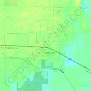
Name: Germantown topographic map, elevation, terrain.

Location: Germantown, Clinton County, Illinois, United States (38.54461 -89.55938 38.56728 -89.53035)

Average elevation: 132 m

Minimum elevation: 122 m

Maximum elevation: 138 m

Other topographic maps

Click on a map to view its topography, its elevation and its terrain.

Shattuc

United States > Illinois > Clinton County

Average elevation: 146 m

Gear up for your next adventure:

🛰️Satellite Messenger - Emergency communication for areas with no cell service
🥽Outdoor Goggles - Protective eyewear for outdoor activities
🥾Mountain Hiking Boots - High-traction boots for rocky terrain
🧢Sun Protection Cap - Breathable cap to protect from sun exposure
🧦Thermal Socks - Warm socks for winter hiking or camping

As an Amazon Associate, this site earns from qualifying purchases at no extra cost to you.