Geolocate

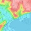
Richborough topographic map

Click on the map to display elevation.

About this map
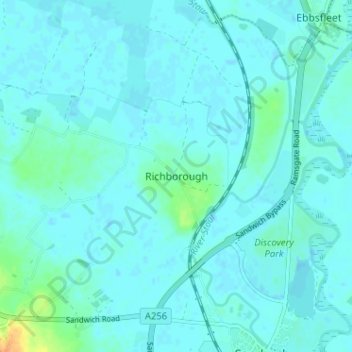
Name: Richborough topographic map, elevation, terrain.

Location: Richborough, Dover, Kent, England, CT13 9JH, United Kingdom (51.27547 1.30524 51.31547 1.34524)

Average elevation: 4 m

Minimum elevation: -1 m

Maximum elevation: 31 m

Other topographic maps

Click on a map to view its topography, its elevation and its terrain.
Dover Castle

United Kingdom > England > Kent > Dover

Average elevation: 47 m

Ash

United Kingdom > England > Kent > Dover

Average elevation: 9 m

Walmer

United Kingdom > England > Kent > Dover

Average elevation: 12 m

Sholden

United Kingdom > England > Kent > Dover

Average elevation: 4 m

Capel-le-Ferne

United Kingdom > England > Kent > Dover

Average elevation: 124 m

Lydden

United Kingdom > England > Kent > Dover

Average elevation: 116 m

River

United Kingdom > England > Kent > Dover

Average elevation: 80 m

Sutton

United Kingdom > England > Kent > Dover > Sutton

Average elevation: 53 m

Stourmouth

United Kingdom > England > Kent > Dover

Average elevation: 4 m

Wingham

United Kingdom > England > Kent > Dover

Average elevation: 22 m

Woodnesborough

United Kingdom > England > Kent > Dover

Average elevation: 15 m

Guston

United Kingdom > England > Kent > Dover

Average elevation: 92 m

Great Mongeham

United Kingdom > England > Kent > Dover

Average elevation: 25 m

Northbourne

United Kingdom > England > Kent > Dover

Average elevation: 26 m

Ripple

United Kingdom > England > Kent > Dover

Average elevation: 43 m

Staple

United Kingdom > England > Kent > Dover

Average elevation: 22 m

Preston

United Kingdom > England > Kent > Dover

Average elevation: 10 m

Aylesham

United Kingdom > England > Kent > Dover

Average elevation: 65 m

Eythorne

United Kingdom > England > Kent > Dover

Average elevation: 72 m

River Stour

United Kingdom > England > Kent > Dover > Ash

Average elevation: 3 m

St. Margaret's at Cliffe

United Kingdom > England > Kent > Dover

Average elevation: 53 m

River

United Kingdom > England > Kent > Dover

Average elevation: 80 m

River

United Kingdom > England > Kent > Dover

Average elevation: 80 m

Wingham

United Kingdom > England > Kent > Dover

Average elevation: 22 m

Ash

United Kingdom > England > Kent > Dover

Average elevation: 9 m

Green Lane Hill

United Kingdom > England > Kent > Dover > Whitfield

Average elevation: 93 m

River

United Kingdom > England > Kent > Dover

Average elevation: 80 m

Whitfield

United Kingdom > England > Kent > Dover > Whitfield

Average elevation: 101 m

Walmer

United Kingdom > England > Kent > Dover

Average elevation: 12 m

River

United Kingdom > England > Kent > Dover

Average elevation: 80 m

Gear up for your next adventure:

🎒Hiking Daypack - Lightweight and durable backpacks for day trips and excursions
🏃Hydration Running Vest - Carry water and maps close to your body for speed
🕶️Polarized Sunglasses - Protect your eyes with durable polarized lenses
🧼Biodegradable Camp Soap - Environmentally friendly cleaning for gear and body
🧥Ultralight Puffy Jacket - Maximum warmth that packs down to the size of an orange

As an Amazon Associate, this site earns from qualifying purchases at no extra cost to you.