Geolocate

Watalgan State Forest topographic map

Click on the map to display elevation.

About this map

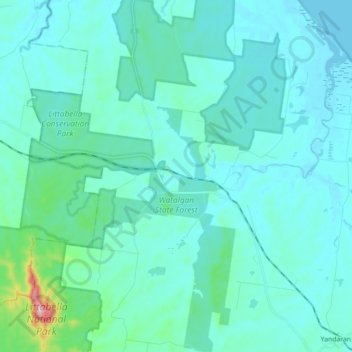
Name: Watalgan State Forest topographic map, elevation, terrain.

Location: Watalgan State Forest, Yandaran, Gladstone Regional, Bundaberg Region, Queensland, 4673, Australia (-24.72840 151.97849 -24.56813 152.06270)

Average elevation: 41 m

Minimum elevation: -5 m

Maximum elevation: 399 m

Other topographic maps

Click on a map to view its topography, its elevation and its terrain.

Gin Gin

Australia > Queensland > Bundaberg Region > Gin Gin

Average elevation: 73 m

Isis River

Australia > Queensland > Bundaberg Region > Buxton

Average elevation: 12 m

Burrum River

Australia > Queensland > Bundaberg Region > Buxton

Average elevation: 20 m

Bundaberg

Australia > Queensland > Bundaberg Region

Average elevation: 18 m

Bundaberg

Australia > Queensland > Bundaberg Region

Average elevation: 18 m

Gear up for your next adventure:

🔥Camping Stove - Portable stoves to cook outdoors with ease
🧴Outdoor Sunscreen - High SPF protection for high-altitude UV exposure
🧴Insect Repellent - Protect yourself from bugs during outdoor adventures
🛶Waterproof Dry Bags - Keep electronics and clothes dry during river crossings
🧭GPS Tracker - Track your location in remote areas safely

As an Amazon Associate, this site earns from qualifying purchases at no extra cost to you.