Geolocate

Gin Gin topographic map

Click on the map to display elevation.

About this map

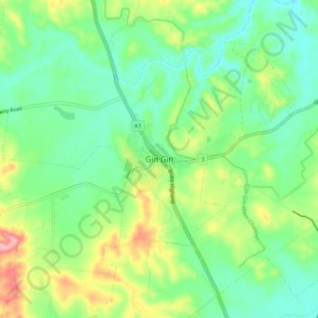
Name: Gin Gin topographic map, elevation, terrain.

Location: Gin Gin, Bundaberg Region, Queensland, Australia (-25.03283 151.91723 -24.95283 151.99723)

Average elevation: 73 m

Minimum elevation: 27 m

Maximum elevation: 168 m

Other topographic maps

Click on a map to view its topography, its elevation and its terrain.

Gin Gin

Australia > Queensland > Bundaberg Region > Gin Gin

Average elevation: 74 m

Gin Gin

Australia > Queensland > Bundaberg Region > Gin Gin

Average elevation: 74 m

Gin Gin

Australia > Queensland > Bundaberg Region > Gin Gin

Average elevation: 74 m

Gear up for your next adventure:

🥾Trekking Boots - Durable boots for long-distance trekking
💡LED Headlamp - Hands-free illumination for night hiking and camping
🛶Waterproof Dry Bags - Keep electronics and clothes dry during river crossings
🔥Emergency Fire Starter - Reliable ignition source for all weather conditions
🧦Thermal Socks - Warm socks for winter hiking or camping

As an Amazon Associate, this site earns from qualifying purchases at no extra cost to you.