Geolocate

Bundaberg topographic map

Click on the map to display elevation.

About this map

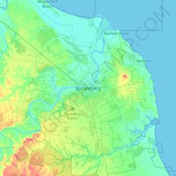
Name: Bundaberg topographic map, elevation, terrain.

Location: Bundaberg, Bundaberg Region, Queensland, Australia (-25.02533 152.19168 -24.70533 152.51168)

Average elevation: 18 m

Minimum elevation: -2 m

Maximum elevation: 92 m

Other topographic maps

Click on a map to view its topography, its elevation and its terrain.

Isis River

Australia > Queensland > Bundaberg Region > Buxton

Average elevation: 12 m

Gear up for your next adventure:

🧭GPS Outdoor Watch - Smart watch for navigation and fitness tracking in nature
🧭GPS Tracker - Track your location in remote areas safely
🧥Thermal Layer - Insulating layer for cold outdoor conditions
🧢Sun Protection Cap - Breathable cap to protect from sun exposure
🔥Emergency Fire Starter - Reliable ignition source for all weather conditions

As an Amazon Associate, this site earns from qualifying purchases at no extra cost to you.