Geolocate

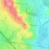
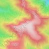
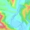
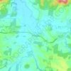
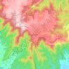
Merri Creek topographic map

Click on the map to display elevation.

About this map

Name: Merri Creek topographic map, elevation, terrain.

Location: Merri Creek, Shire of Mitchell, Hume, Victoria, 3756, Australia (-37.42222 145.00617 -37.42135 145.00633)

Average elevation: 300 m

Minimum elevation: 293 m

Maximum elevation: 358 m

Other topographic maps

Click on a map to view its topography, its elevation and its terrain.
City of Melbourne

Australia > Victoria

Melbourne's topography is characterized by a diverse landscape that transitions from flat coastal plains to rolling hills and mountainous regions. The city is situated at the northern end of Port Phillip Bay, where the terrain is predominantly flat, facilitating urban development. As one moves eastward, the…

Average elevation: 18 m
Melbourne

Australia > Victoria

Melbourne is also prone to isolated convective showers forming when a cold pool crosses the state, especially if there is considerable daytime heating. These showers are often heavy and can include hail, squalls, and significant drops in temperature, but they often pass through very quickly with a rapid…

Average elevation: 185 m
Melbourne

Australia > Victoria

Melbourne is also prone to isolated convective showers forming when a cold pool crosses the state, especially if there is considerable daytime heating. These showers are often heavy and can include hail, squalls, and significant drops in temperature, but they often pass through very quickly with a rapid…

Average elevation: 185 m

Bendigo

Australia > Victoria

Average elevation: 223 m

Doreen

Australia > Victoria

Average elevation: 159 m

Plenty River

Australia > Victoria > Melbourne

Average elevation: 214 m

Warrnambool

Australia > Victoria

Average elevation: 19 m

Buchan

Australia > Victoria

Average elevation: 399 m

Lysterfield

Australia > Victoria

Average elevation: 128 m

Geelong

Australia > Victoria

Average elevation: 42 m

Warburton

Australia > Victoria

Average elevation: 525 m

Melbourne

Australia > Victoria

Melbourne is also prone to isolated convective showers forming when a cold pool crosses the state, especially if there is considerable daytime heating. These showers are often heavy and can include hail, squalls, and significant drops in temperature, but they often pass through very quickly with a rapid…

Average elevation: 49 m

Smiths Beach

Australia > Victoria

Average elevation: 24 m

Ballarat

Australia > Victoria

Ballarat has a moderate oceanic climate (Köppen climate classification Cfb) with four distinct seasons. Its elevation, ranging between 400 and 630 metres (1,310 and 2,070 feet) above sea level, causes its mean monthly temperatures to tend to be on average 3 to 5 °C (5 to 9 °F) below those of Melbourne,…

Average elevation: 470 m
Footscray

Australia > Victoria > Melbourne

Average elevation: 19 m

Bright

Australia > Victoria

Average elevation: 550 m

Mirboo North

Australia > Victoria

Average elevation: 216 m

Gherang

Australia > Victoria

Average elevation: 137 m

Wodonga

Australia > Victoria

Average elevation: 191 m

Noorinbee

Australia > Victoria

Average elevation: 233 m

Wheelers Hill

Australia > Victoria

Average elevation: 85 m

Thornbury

Australia > Victoria

Average elevation: 54 m

Mount Bogong

Australia > Victoria

The Big River separates the massif of the mountain from the Bogong High Plains to the south. From the nearby town of Mount Beauty to its summit, Mount Bogong rises more than 1,600 metres (5,200 ft), thus making it one of the highest peaks in Australia not only in terms of its elevation above sea level, but…

Average elevation: 1,719 m

Werribee River

Australia > Victoria

Average elevation: 302 m

Portarlington

Australia > Victoria

Average elevation: 38 m

Carlsruhe

Australia > Victoria

Average elevation: 533 m

Lake Eppalock

Australia > Victoria

Average elevation: 219 m

Mount Howitt

Australia > Victoria

Average elevation: 1,467 m

Allans Flat

Australia > Victoria

Average elevation: 223 m

Hawthorn

Australia > Victoria > Melbourne

Average elevation: 33 m

Eltham District

Australia > Victoria > Melbourne

Average elevation: 85 m

Mount Waverley District

Australia > Victoria

Average elevation: 100 m

Pascoe Vale District

Australia > Victoria > Melbourne

Average elevation: 73 m

Clayton

Australia > Victoria > Melbourne

Average elevation: 79 m

Belgrave

Australia > Victoria > Melbourne > Belgrave

Average elevation: 220 m

Echuca

Australia > Victoria

Average elevation: 100 m

Glen Waverley

Australia > Victoria

Average elevation: 103 m

Rochester

Australia > Victoria

Average elevation: 116 m

Gippsland

Australia > Victoria

Average elevation: 273 m

Mount Alexander

Australia > Victoria

Average elevation: 561 m

Sorrento

Australia > Victoria

Average elevation: 9 m

Mickleham

Australia > Victoria > Melbourne

Average elevation: 238 m

Avenel

Australia > Victoria

Average elevation: 282 m

Clonbinane

Australia > Victoria

Average elevation: 457 m

Yea

Australia > Victoria

Average elevation: 214 m

Frankston

Australia > Victoria > Frankston

Olivers Hill is the most prominent elevation in Frankston which rises to 55 metres above sea level (180 feet) at its highest point in the suburb. Its origins date to approximately 415 to 360 million years ago. Its base is Mount Eliza Granite dating from the Devonian period, which was covered in lava tuffs in…

Average elevation: 36 m
Mount Dandenong

Australia > Victoria

Mount Dandenong has an oceanic climate (Cfb) with warm summers and cool winters. The temperature usually is 3 - 7 °C (5.4 - 12.6 °F) cooler than downtown Melbourne due to its elevation and distance from the urban island heating effect of Melbourne.

Average elevation: 408 m
Mount Macedon

Australia > Victoria

Average elevation: 755 m

Grampians

Australia > Victoria

Average elevation: 151 m

Ferntree Gully District

Australia > Victoria

Average elevation: 92 m

Blairgowrie

Australia > Victoria

Average elevation: 7 m

Licola

Australia > Victoria

Average elevation: 328 m

Yackandandah

Australia > Victoria

Average elevation: 469 m

Omeo

Australia > Victoria

There are bus routes from Bright and Bairnsdale. The Bairnsdale bus runs weekdays, once both directions, and the Bright bus (Alps Link) timetable is less frequent in Summer and runs additional services during the ski season. Alps Link is the highest altitude public bus in Australia. The town sits at the…

Average elevation: 861 m
Frankston

Australia > Victoria

Olivers Hill is the most prominent elevation in Frankston which rises to 55 metres above sea level (180 feet) at its highest point in the suburb. Its origins date to approximately 415 to 360 million years ago. Its base is Mount Eliza Granite dating from the Devonian period, which was covered in lava tuffs in…

Average elevation: 40 m
Great Otway National Park

Australia > Victoria

Average elevation: 91 m

Shepparton

Australia > Victoria

Average elevation: 116 m

Mount Feathertop

Australia > Victoria

Average elevation: 1,533 m

Marcus Hill

Australia > Victoria

Average elevation: 40 m

Woodend

Australia > Victoria

Average elevation: 603 m

Venus Bay

Australia > Victoria

Average elevation: 3 m

Eppalock

Australia > Victoria

Average elevation: 214 m

Strzelecki

Australia > Victoria

Average elevation: 233 m

Teesdale

Australia > Victoria

Average elevation: 134 m

Cobberas

Australia > Victoria

Average elevation: 1,230 m

Poowong

Australia > Victoria

Average elevation: 161 m

Western Port

Australia > Victoria

Formerly a major river drainage system, it was inundated together with Port Phillip by the rising sea in the Holocene period; the Western Port sunkland now forms an extensive tidal bay. The waters of Western Port cover an area of 680 km² of which 270 km² are exposed as mud flats at low tide. The topography…

Average elevation: 35 m

Moliagul

Australia > Victoria

Average elevation: 263 m

Woori Yallock

Australia > Victoria

Average elevation: 145 m

Leongatha

Australia > Victoria

Average elevation: 76 m

Reedy Creek

Australia > Victoria

Reedy Creek is a locality in central Victoria, Australia. The locality is in the Shire of Mitchell local government area, 99 kilometres (62 mi) north of the state capital, Melbourne. It is at 358 metres (1175 feet) elevation. It is approximately 15 minutes from Broadford, Vic, 3658.

Average elevation: 375 m

Loch Sport

Australia > Victoria

Average elevation: 2 m

Noojee

Australia > Victoria

Average elevation: 334 m

Maribyrnong

Australia > Victoria > Melbourne

Average elevation: 23 m

Sunbury

Australia > Victoria

Average elevation: 275 m

Croydon

Australia > Victoria

Average elevation: 125 m

Kinglake

Australia > Victoria > Kinglake

Average elevation: 416 m

Pakenham

Australia > Victoria > Melbourne

Average elevation: 56 m

Mount Buller

Australia > Victoria

Due to its far south-western location in the alpine region, Mount Buller is more susceptible to cold airmasses which allow it to record some of the lowest maximum temperatures and daytime readings in the country, despite being considerably lower in elevation than other mountain sites to the north-east. On 5…

Average elevation: 824 m
Surrey Hills

Australia > Victoria

Average elevation: 96 m

Langwarrin

Australia > Victoria > Melbourne

Average elevation: 71 m

Halls Gap

Australia > Victoria

Average elevation: 406 m

Kyneton

Australia > Victoria

Average elevation: 504 m

Traralgon

Australia > Victoria

Average elevation: 53 m

Warragul

Australia > Victoria > Warragul

Average elevation: 133 m

Dromana

Australia > Victoria

Average elevation: 64 m

Monbulk District

Australia > Victoria > Melbourne

Average elevation: 213 m

Grampians National Park

Australia > Victoria

Mount William is known within the gliding community for the "Grampians Wave", a weather phenomenon that sometimes enables glider pilots to reach extreme altitudes of the order of 28,000 ft (8,500 m). This predominantly occurs during the months of May, June, September and October when strong westerly winds flow…

Average elevation: 262 m
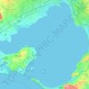
Port Phillip

Australia > Victoria

Port Phillip's mostly flat topography and moderate waves make perfect conditions for recreational swimming, kitesurfing, windsurfing, sailing, boating, snorkeling, scuba diving, stand up paddle boarding (SUP) and other sports.

Average elevation: 18 m

Botanic Ridge

Australia > Victoria

Average elevation: 72 m

Shire of South Gippsland

Australia > Victoria

Average elevation: 81 m

Krowera

Australia > Victoria

Average elevation: 157 m

Mount Terrible

Australia > Victoria

Average elevation: 958 m

Pipers Creek

Australia > Victoria

Average elevation: 538 m

Costerfield

Australia > Victoria

Average elevation: 217 m

Glenmaggie

Australia > Victoria

Average elevation: 86 m

Happy Go Lucky

Australia > Victoria

Average elevation: 403 m

Wattle Hill

Australia > Victoria

Average elevation: 239 m

Mount Bunroy

Australia > Victoria

Average elevation: 591 m

French Island

Australia > Victoria

Average elevation: 12 m

Gear up for your next adventure:

🪑Insulated Seat Pad - Protect your seat from cold rocks and wet logs
🧢Outdoor Cap - Protective cap for sun and rain during hikes
🧥Waterproof Pants - Keep dry during rainy hiking conditions
🛏️Camping Sleeping Mat - Comfortable mats for sleeping outdoors
🧥Insulated Jacket - Keep warm in cold outdoor conditions

As an Amazon Associate, this site earns from qualifying purchases at no extra cost to you.