Geolocate

Ararat topographic map

Click on the map to display elevation.

About this map

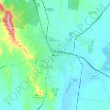
Name: Ararat topographic map, elevation, terrain.

Location: Ararat, Rural City of Ararat, Victoria, 3377, Australia (-37.32434 142.89062 -37.24434 142.97062)

Average elevation: 334 m

Minimum elevation: 283 m

Maximum elevation: 576 m

Gear up for your next adventure:

🕶️Polarized Sunglasses - Reduces glare from snow and water at high elevations
🧥Waterproof Hiking Jacket - Protect yourself from rain and wind while hiking
🧥Waterproof Jacket - Lightweight rain jackets for hiking and outdoor activities
Camping Groundsheet - Protect your tent from moisture and dirt
🧊Portable Cooler - Keep food and drinks cold during outdoor adventures

As an Amazon Associate, this site earns from qualifying purchases at no extra cost to you.