
Hà Nội topographic map
Interactive map
Click on the map to display elevation.
About this map
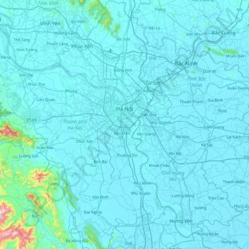
Name: Hà Nội topographic map, elevation, terrain.
Location: Hà Nội, Vietnam (20.56452 105.28896 21.38528 106.02007)
Average elevation: 37 m
Minimum elevation: -3 m
Maximum elevation: 1,082 m
Other topographic maps
Click on a map to view its topography, its elevation and its terrain.
Ho Chi Minh City
Ho Chi Minh City is located in the south-eastern region of Vietnam, 1,760 km (1,090 mi) south of Hanoi. The average elevation is 5 m (16 ft) above sea level for the city center and 16 m (52 ft) for the suburb areas. It borders Tây Ninh Province and Bình Dương Province to the north, Đồng Nai Province and…
Average elevation: 6 m
Mỹ Thuận
Vietnam > Bà Rịa - Vũng Tàu Province > Long Dat District > Phuoc Hai Township
Average elevation: 10 m
Quảng trường Thành phố Phan Rang-Tháp Chàm
Vietnam > Ninh Thuan province > Phan Rang – Tháp Chàm
Average elevation: 5 m
Bắc Hưng Hải River
Vietnam > Hung Yen Province > Văn Giang District > Hà Nội > Xã Bát Tràng
Average elevation: 9 m
Bản Nậm Cung
Vietnam > Lai Chau province > Phong Thổ District > Mường So Commune
Average elevation: 489 m
Thi Vai River
Vietnam > Bà Rịa - Vũng Tàu Province > Long Thành District > Phú Mỹ
Average elevation: 10 m
Hạ Long Bay
Vietnam > Quang Ninh Province > Ha Long
Due to a simultaneous combination of ideal factors such as thick, pale, grey, and strong limestone layers, which are formed by fine-grained materials; hot and moist climate and slow tectonic process as a whole; Hạ Long Bay has had a complete karst evolution for 20 million years. There are many types of karst…
Average elevation: 0 m
Sin Cowe East Island
Vietnam > Khanh Hoa province > Trường Sa District > Sinh Tồn Đông
Average elevation: 0 m
Central London Reef
Vietnam > Khanh Hoa province > Trường Sa District > Trường Sa
Average elevation: 0 m
Southwest Cay
Vietnam > Khanh Hoa province > Trường Sa District > Xã Song Tử Tây
Average elevation: 0 m