
Thank you for supporting this site ❤️
Make a donation
Make a donation
Gear up for your next adventure:
As an Amazon Associate, this site earns from qualifying purchases at no extra cost to you.
Làng Nủ topographic map
Click on the map to display elevation.
Thank you for supporting this site ❤️
Make a donation
Make a donation
Gear up for your next adventure:
As an Amazon Associate, this site earns from qualifying purchases at no extra cost to you.
About this map
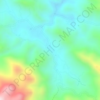
Name: Làng Nủ topographic map, elevation, terrain.
Location: Làng Nủ, Bảo Yên District, Lào Cai Province, Vietnam (22.13643 104.52382 22.15643 104.54382)
Average elevation: 271 m
Minimum elevation: 135 m
Maximum elevation: 613 m
Thank you for supporting this site ❤️
Make a donation
Make a donation
Gear up for your next adventure:
As an Amazon Associate, this site earns from qualifying purchases at no extra cost to you.