
Thank you for supporting this site ❤️
Make a donation
Make a donation
Gear up for your next adventure:
As an Amazon Associate, this site earns from qualifying purchases at no extra cost to you.
Thôn 1 topographic map
Click on the map to display elevation.
Thank you for supporting this site ❤️
Make a donation
Make a donation
Gear up for your next adventure:
As an Amazon Associate, this site earns from qualifying purchases at no extra cost to you.
About this map
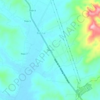
Name: Thôn 1 topographic map, elevation, terrain.
Location: Thôn 1, Đăk La, Đăk Hà District, Kon Tum Province, Vietnam (14.42147 107.93614 14.46147 107.97614)
Average elevation: 567 m
Minimum elevation: 528 m
Maximum elevation: 744 m
Thank you for supporting this site ❤️
Make a donation
Make a donation
Gear up for your next adventure:
As an Amazon Associate, this site earns from qualifying purchases at no extra cost to you.