
Thank you for supporting this site ❤️
Make a donation
Make a donation
Gear up for your next adventure:
As an Amazon Associate, this site earns from qualifying purchases at no extra cost to you.
Núi Ngok Linh topographic map
Click on the map to display elevation.
Thank you for supporting this site ❤️
Make a donation
Make a donation
Gear up for your next adventure:
As an Amazon Associate, this site earns from qualifying purchases at no extra cost to you.
About this map
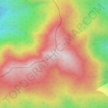
Name: Núi Ngok Linh topographic map, elevation, terrain.
Location: Núi Ngok Linh, Đăk Glei District, Kon Tum Province, Vietnam (15.06899 107.97489 15.06909 107.97499)
Average elevation: 2,289 m
Minimum elevation: 1,850 m
Maximum elevation: 2,571 m
Thank you for supporting this site ❤️
Make a donation
Make a donation
Gear up for your next adventure:
As an Amazon Associate, this site earns from qualifying purchases at no extra cost to you.