
North Leverton with Habblesthorpe topographic map
Interactive map
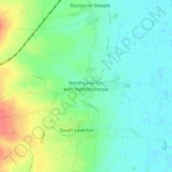
Click on the map to display elevation.
About this map
Name: North Leverton with Habblesthorpe topographic map, elevation, terrain.
Average elevation: 20 m
Minimum elevation: 3 m
Maximum elevation: 60 m
Other topographic maps
Click on a map to view its topography, its elevation and its terrain.
Worksop
United Kingdom > England > Nottinghamshire > Bassetlaw
Worksop, Bassetlaw, Nottinghamshire, England, S80 1JB, United Kingdom
Average elevation: 56 m
Retford
United Kingdom > England > Nottinghamshire > Bassetlaw
Retford, Bassetlaw, Nottinghamshire, England, DN22 6DR, United Kingdom
Average elevation: 31 m
Rhodesia
United Kingdom > England > Nottinghamshire > Bassetlaw > Worksop
Rhodesia, Worksop, Bassetlaw, Nottinghamshire, England, United Kingdom
Average elevation: 48 m
East Markham
United Kingdom > England > Nottinghamshire > Bassetlaw
East Markham, Bassetlaw, Nottinghamshire, England, NG22 0RE, United Kingdom
Average elevation: 46 m
Mattersey Thorpe
United Kingdom > England > Nottinghamshire > Bassetlaw > Mattersey
Mattersey Thorpe, Mattersey, Bassetlaw, Nottinghamshire, England, DN10 5EF, United Kingdom
Average elevation: 12 m
Skegby
United Kingdom > England > Nottinghamshire > Bassetlaw > Normanton on Trent
Skegby, Marnham, Normanton on Trent, Bassetlaw, Nottinghamshire, England, NG23 6SA, United Kingdom
Average elevation: 18 m
Cuckney
United Kingdom > England > Nottinghamshire > Bassetlaw
Cuckney, Bassetlaw, Nottinghamshire, England, NG20 9NQ, United Kingdom
Average elevation: 67 m
Bothamsall
United Kingdom > England > Nottinghamshire > Bassetlaw
Bothamsall, Bassetlaw, Nottinghamshire, England, United Kingdom
Average elevation: 37 m
Woodbeck
United Kingdom > England > Nottinghamshire > Bassetlaw > Treswell
Woodbeck, Rampton and Woodbeck, Treswell, Bassetlaw, Nottinghamshire, England, DN22 0JF, United Kingdom
Average elevation: 30 m
Elkesley
United Kingdom > England > Nottinghamshire > Bassetlaw
Elkesley, Bassetlaw, Nottinghamshire, England, DN22 8AN, United Kingdom
Average elevation: 30 m
Welham
United Kingdom > England > Nottinghamshire > Bassetlaw
Welham, Bassetlaw, Nottinghamshire, England, DN22 0SG, United Kingdom
Average elevation: 39 m
Stokeham
United Kingdom > England > Nottinghamshire > Bassetlaw
Stokeham, Bassetlaw, Nottinghamshire, England, DN22 0JZ, United Kingdom
Average elevation: 21 m
North Wheatley
United Kingdom > England > Nottinghamshire > Bassetlaw
North Wheatley, Bassetlaw, Nottinghamshire, England, DN22 9DB, United Kingdom
Average elevation: 34 m
Ordsall
United Kingdom > England > Nottinghamshire > Bassetlaw
Ordsall, Bassetlaw, Nottinghamshire, England, United Kingdom
Average elevation: 25 m
Sutton
United Kingdom > England > Nottinghamshire > Bassetlaw
Sutton, Bassetlaw, Nottinghamshire, England, DN22 8PP, United Kingdom
Average elevation: 16 m
Walkeringham
United Kingdom > England > Nottinghamshire > Bassetlaw > Walkeringham
Walkeringham, Bassetlaw, Nottinghamshire, East Midlands, England, DN10 4HQ, United Kingdom
Average elevation: 16 m
South Leverton
United Kingdom > England > Nottinghamshire > Bassetlaw > South Leverton
South Leverton, Bassetlaw, Nottinghamshire, England, DN22 0FB, United Kingdom
Average elevation: 22 m
Scrooby
United Kingdom > England > Nottinghamshire > Bassetlaw > Scrooby
Scrooby, Bassetlaw, Nottinghamshire, England, United Kingdom
Average elevation: 13 m
Misterton
United Kingdom > England > Nottinghamshire > Bassetlaw
Misterton, Bassetlaw, Nottinghamshire, England, United Kingdom
Average elevation: 6 m
Bircotes
United Kingdom > England > Nottinghamshire > Bassetlaw
Bircotes, Bassetlaw, Nottinghamshire, England, DN11 8AB, United Kingdom
Average elevation: 24 m
Tuxford
United Kingdom > England > Nottinghamshire > Bassetlaw
Tuxford, Bassetlaw, Nottinghamshire, England, United Kingdom
Average elevation: 47 m
Lound
United Kingdom > England > Nottinghamshire > Bassetlaw > Lound
Lound, Bassetlaw, Nottinghamshire, East Midlands, England, DN22 8RH, United Kingdom
Average elevation: 12 m
Carburton
United Kingdom > England > Nottinghamshire > Bassetlaw > Carburton
Carburton, Bassetlaw, Nottinghamshire, East Midlands, England, United Kingdom
Average elevation: 60 m
Littleborough
United Kingdom > England > Nottinghamshire > Bassetlaw > Littleborough
Littleborough, Sturton le Steeple, Bassetlaw, Nottinghamshire, East Midlands, England, DN22 0HD, United Kingdom
Average elevation: 10 m
Holbeck
United Kingdom > England > Nottinghamshire > Bassetlaw
Holbeck, Bassetlaw, Nottinghamshire, England, S80 3NF, United Kingdom
Average elevation: 73 m
Gringley on the Hill
United Kingdom > England > Nottinghamshire > Bassetlaw
Gringley on the Hill, Bassetlaw, Nottinghamshire, England, United Kingdom
Average elevation: 15 m
Gamston
United Kingdom > England > Nottinghamshire > Bassetlaw
Gamston, Bassetlaw, Nottinghamshire, England, DN22 0QD, United Kingdom
Average elevation: 31 m
Clumber Park
United Kingdom > England > Nottinghamshire > Bassetlaw > Worksop
Clumber Park, Worksop, Bassetlaw, Nottinghamshire, England, United Kingdom
Average elevation: 53 m
Nether Langwith
United Kingdom > England > Nottinghamshire > Bassetlaw
Nether Langwith, Bassetlaw, Nottinghamshire, England, NG20 9EW, United Kingdom
Average elevation: 89 m
Rampton
United Kingdom > England > Nottinghamshire > Bassetlaw
Rampton, Bassetlaw, Nottinghamshire, England, DN22 0HR, United Kingdom
Average elevation: 13 m
Treswell
United Kingdom > England > Nottinghamshire > Bassetlaw
Treswell, Bassetlaw, Nottinghamshire, England, DN22 0EJ, United Kingdom
Average elevation: 24 m
Torworth
United Kingdom > England > Nottinghamshire > Bassetlaw
Torworth, Bassetlaw, Nottinghamshire, England, DN22 8NU, United Kingdom
Average elevation: 18 m
Blyth
United Kingdom > England > Nottinghamshire > Bassetlaw
Blyth, Bassetlaw, Nottinghamshire, England, United Kingdom
Average elevation: 18 m
Harworth
United Kingdom > England > Nottinghamshire > Bassetlaw
Harworth, Bassetlaw, Nottinghamshire, England, DN11 8LB, United Kingdom
Average elevation: 24 m
Torworth
United Kingdom > England > Nottinghamshire > Bassetlaw
Ranskill, Torworth, Bassetlaw, Nottinghamshire, England, United Kingdom
Average elevation: 15 m
Styrrup
United Kingdom > England > Nottinghamshire > Bassetlaw
Styrrup, Bassetlaw, Nottinghamshire, England, DN11 8LZ, United Kingdom
Average elevation: 22 m
Oldcotes
United Kingdom > England > Nottinghamshire > Bassetlaw
Oldcotes, Bassetlaw, Nottinghamshire, England, S81 8HX, United Kingdom
Average elevation: 34 m
Clarborough
United Kingdom > England > Nottinghamshire > Bassetlaw
Clarborough, Bassetlaw, Nottinghamshire, England, DN22 9LR, United Kingdom
Average elevation: 34 m