Geolocate

Scrooby topographic map

Click on the map to display elevation.

About this map

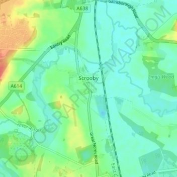
Name: Scrooby topographic map, elevation, terrain.

Location: Scrooby, Bassetlaw, Nottinghamshire, England, United Kingdom (53.38967 -1.04004 53.42674 -0.99539)

Average elevation: 13 m

Minimum elevation: 0 m

Maximum elevation: 45 m

Gear up for your next adventure:

🔭Compact Monocular - One-handed bird watching and trail spotting
🥾Light Trekking Boots - Supportive boots for multi-day treks
🥾Mountaineering Boots - Supportive boots for climbing and high-altitude hiking
🧤Thermal Hiking Gloves - Grip-enhanced gloves for cold-weather altitude trekking
🦶Hiking Shoe Insoles - Added support for high arches and long days on feet

As an Amazon Associate, this site earns from qualifying purchases at no extra cost to you.