Geolocate

Querari topographic map

Click on the map to display elevation.

About this map

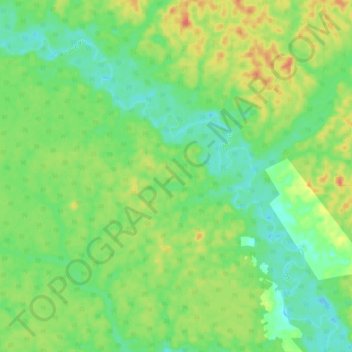
Name: Querari topographic map, elevation, terrain.

Location: Querari, Mitú, Vaupés, RAP Amazonía, Colombia (1.51268 -70.30686 1.60657 -70.19763)

Average elevation: 190 m

Minimum elevation: 169 m

Maximum elevation: 222 m

Other topographic maps

Click on a map to view its topography, its elevation and its terrain.

Tiquie

Colombia > Vaupés > Mitú

Average elevation: 150 m

Acaricuara

Colombia > Vaupés > Mitú > Acaricuara

Average elevation: 170 m

Mandi

Colombia > Vaupés > Mitú > Mandi

Average elevation: 200 m

Caruru

Colombia > Vaupés > Mitú

Average elevation: 187 m

Villa Fátima (Tipiaca

Colombia > Vaupés > Mitú

Average elevation: 165 m

Gear up for your next adventure:

🦶Hiking Shoe Insoles - Added support for high arches and long days on feet
🌬️Windproof Camp Stove - Efficient cooking even on exposed mountain peaks
🔦LED Flashlight - Powerful and long-lasting flashlight for camping and emergencies
💧Collapsible Water Bottle - Space-saving water bottle for outdoor activities
🧼Biodegradable Camp Soap - Environmentally friendly cleaning for gear and body

As an Amazon Associate, this site earns from qualifying purchases at no extra cost to you.