Geolocate

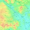
Silong topographic map

Click on the map to display elevation.

About this map

Name: Silong topographic map, elevation, terrain.

Location: Silong, Nanning, Guangxi, China (23.12785 108.60807 23.20785 108.68807)

Average elevation: 334 m

Minimum elevation: 147 m

Maximum elevation: 764 m

Other topographic maps

Click on a map to view its topography, its elevation and its terrain.

Xixiangtang District

China > Guangxi > Nanning

Average elevation: 130 m

Heng County

China > Guangxi > Nanning

Average elevation: 135 m

Qingxiu District

China > Guangxi > Nanning

Average elevation: 140 m

Xingning District

China > Guangxi > Nanning

Average elevation: 191 m

Liangqing

China > Guangxi > Nanning

Average elevation: 98 m

Long'an County

China > Guangxi > Nanning

Average elevation: 255 m

Yongning District

China > Guangxi > Nanning

Average elevation: 118 m

Gear up for your next adventure:

🛶Kayak Accessories - Essential gear for safe and fun kayaking adventures
🧦Hiking Liner Socks - Thin base layer to prevent friction and blisters
🧥Thermal Fleece Jacket - Versatile insulation for changing mountain temperatures
🥘Camping Cookware Set - Compact nesting pots and pans for trail cooking
🧢Outdoor Visor - Breathable visor for sunny hikes

As an Amazon Associate, this site earns from qualifying purchases at no extra cost to you.