Geolocate

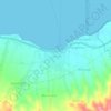
Magepanda topographic map

Click on the map to display elevation.

About this map

Name: Magepanda topographic map, elevation, terrain.

Location: Magepanda, Sikka, East Nusa Tenggara, Indonesia (-8.62316 121.97679 -8.51326 122.14104)

Average elevation: 396 m

Minimum elevation: 0 m

Maximum elevation: 1,408 m

Other topographic maps

Click on a map to view its topography, its elevation and its terrain.

Riit

Indonesia > East Nusa Tenggara > Sikka

Average elevation: 856 m

Maumere

Indonesia > East Nusa Tenggara > Sikka

Average elevation: 53 m

Maumere

Indonesia > East Nusa Tenggara > Sikka

Average elevation: 53 m

Gilting

Indonesia > East Nusa Tenggara > Sikka

Average elevation: 23 m

Gear up for your next adventure:

🔥Emergency Fire Starter - Reliable ignition source for all weather conditions
🛶Kayak Dry Bag - Waterproof storage for kayaking adventures
🧥Waterproof Jacket - Lightweight rain jackets for hiking and outdoor activities
💧Hydration Bladder - Hands-free hydration solution for long treks
🧥Waterproof Pants - Keep dry during rainy hiking conditions

As an Amazon Associate, this site earns from qualifying purchases at no extra cost to you.