Geolocate

Maumere topographic map

Click on the map to display elevation.

About this map
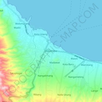
Name: Maumere topographic map, elevation, terrain.

Location: Maumere, Sikka, East Nusa Tenggara, Lesser Sunda Islands, 86111, Indonesia (-8.66565 122.17929 -8.58565 122.25929)

Average elevation: 53 m

Minimum elevation: 0 m

Maximum elevation: 281 m

Other topographic maps

Click on a map to view its topography, its elevation and its terrain.

Magepanda

Indonesia > East Nusa Tenggara > Sikka

Average elevation: 396 m

Gear up for your next adventure:

📷Outdoor Action Camera - Capture high-elevation views and rugged adventures
🧤Rechargeable Heated Gloves - Extreme warmth for Canadian winter expeditions
⛺Bushcraft Tarp - Versatile emergency shelter or gear protection
⛺Camping Tent - Weather-resistant tents suitable for 2 to 6 people
🥾Trekking Boots - Durable boots for long-distance trekking

As an Amazon Associate, this site earns from qualifying purchases at no extra cost to you.