Geolocate

Maumere topographic map

Click on the map to display elevation.

About this map
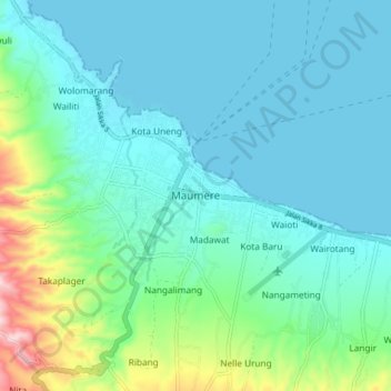
Name: Maumere topographic map, elevation, terrain.

Location: Maumere, Sikka, East Nusa Tenggara, 86111, Indonesia (-8.66565 122.17929 -8.58565 122.25929)

Average elevation: 53 m

Minimum elevation: 0 m

Maximum elevation: 281 m

Other topographic maps

Click on a map to view its topography, its elevation and its terrain.

Magepanda

Indonesia > East Nusa Tenggara > Sikka

Average elevation: 396 m

Gear up for your next adventure:

🧤Insulated Winter Gloves - Heavy-duty protection for sub-zero Canadian adventures
🧰Survival Kit - Essential gear for emergencies in the wilderness
🧣Evaporative Cooling Towel - Beat the heat during intense summer climbs
⛺Bushcraft Tarp - Versatile emergency shelter or gear protection
🔨Vehicle Emergency Tool - Safety tool for remote road trips to trailheads

As an Amazon Associate, this site earns from qualifying purchases at no extra cost to you.