Geolocate

Respaldiza topographic map

Click on the map to display elevation.

About this map

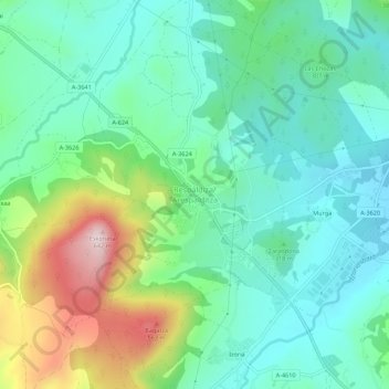
Name: Respaldiza topographic map, elevation, terrain.

Location: Respaldiza, Ayala, Álava, País Vasco, 01476, España (43.05752 -3.06357 43.09752 -3.02357)

Average elevation: 318 m

Minimum elevation: 199 m

Maximum elevation: 625 m

Other topographic maps

Click on a map to view its topography, its elevation and its terrain.

Luyando

España > País Vasco > Ayala

Average elevation: 321 m

Maroño

España > País Vasco > Ayala

Average elevation: 375 m

Gear up for your next adventure:

Lightweight Backpacking Tent - Compact tent for efficient hiking trips
🥾Trekking Poles - Adjustable trekking poles to reduce knee stress and improve stability
🥾All-Terrain Hiking Boots - Versatile boots for varied hiking conditions
🧦Hiking Liner Socks - Thin base layer to prevent friction and blisters
🥾Approach Shoes - Shoes designed for climbing approaches and rugged trails

As an Amazon Associate, this site earns from qualifying purchases at no extra cost to you.