
太安 topographic map
Interactive map
Click on the map to display elevation.
About this map
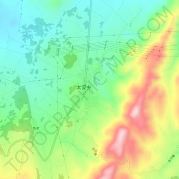
Name: 太安 topographic map, elevation, terrain.
Location: 太安, 玉龙纳西族自治县, 丽江市, 云南省, 中国 (26.76162 100.06401 26.80162 100.10401)
Average elevation: 2,802 m
Minimum elevation: 2,680 m
Maximum elevation: 3,007 m
Other topographic maps
Click on a map to view its topography, its elevation and its terrain.