Geolocate

Barton topographic map

Click on the map to display elevation.

About this map

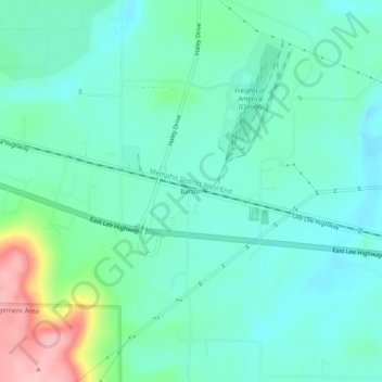
Name: Barton topographic map, elevation, terrain.

Location: Barton, Colbert County, Alabama, United States (34.71870 -87.91115 34.75870 -87.87115)

Average elevation: 160 m

Minimum elevation: 124 m

Maximum elevation: 280 m

Other topographic maps

Click on a map to view its topography, its elevation and its terrain.

Tuscumbia

United States > Alabama > Colbert County

Average elevation: 159 m

Leighton

United States > Alabama > Colbert County

Average elevation: 175 m

Muscle Shoals

United States > Alabama > Colbert County

Average elevation: 156 m

Cherokee

United States > Alabama > Colbert County

Average elevation: 165 m

Muscle Shoals

United States > Alabama > Colbert County

Average elevation: 156 m

Leighton

United States > Alabama > Colbert County

Average elevation: 175 m

Leighton

United States > Alabama > Colbert County

Average elevation: 176 m

Gear up for your next adventure:

❄️Traction Ice Cleats - Slip-on spikes for icy trails and winter hiking
🦌Outdoor Trail Camera - Monitor wildlife activity near your favorite spots
🚲Bike Repair Kit - Essential tools for on-trail mechanical issues
💡LED Camping Lantern - Illuminate your campsite with long-lasting lanterns
👖Convertible Hiking Pants - Zip-off legs to adapt to changing weather conditions

As an Amazon Associate, this site earns from qualifying purchases at no extra cost to you.