
Mount Atago topographic map
Click on the map to display elevation.
About this map
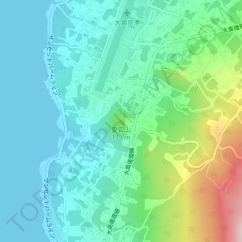
Name: Mount Atago topographic map, elevation, terrain.
Location: Mount Atago, Tokyo, Japan (34.77053 139.35975 34.77063 139.35985)
Average elevation: 60 m
Minimum elevation: 0 m
Maximum elevation: 248 m
Other topographic maps
Click on a map to view its topography, its elevation and its terrain.
Miyakejima
The island is a stratovolcano with a granitic composite cone, dating from the late Pleistocene period, between 10,000 and 2,000 years ago. The island has a roughly circular coastline, 88.3 kilometers in length, with an average diameter of eight kilometers. The highest elevation Mount Oyama (雄山, Oyama-san)…
Average elevation: 168 m