Geolocate

Franklin topographic map

Interactive map

Click on the map to display elevation.

About this map

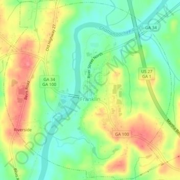
Name: Franklin topographic map, elevation, terrain.

Location: Franklin, Heard County, Georgia, United States (33.26370 -85.11581 33.29466 -85.08126)

Average elevation: 223 m

Minimum elevation: 187 m

Maximum elevation: 266 m

Other topographic maps

Click on a map to view its topography, its elevation and its terrain.

Glenn

United States > Georgia > Heard County

Glenn, Heard County, Georgia, United States

Average elevation: 239 m

Houston

United States > Georgia > Heard County

Houston, Heard County, Georgia, 30219, United States

Average elevation: 229 m

Cooksville

United States > Georgia > Heard County

Cooksville, Heard County, Georgia, United States

Average elevation: 212 m

Glenloch

United States > Georgia > Heard County

Glenloch, Heard County, Georgia, United States

Average elevation: 289 m

Roosterville

United States > Georgia > Heard County

Roosterville, Heard County, Georgia, 30170, United States

Average elevation: 302 m

Viola

United States > Georgia > Heard County

Viola, Heard County, Georgia, United States

Average elevation: 237 m

Owensbyville

United States > Georgia > Heard County

Owensbyville, Heard County, Georgia, United States

Average elevation: 214 m

Centralhatchee

United States > Georgia > Heard County

Centralhatchee, Heard County, Georgia, United States

Average elevation: 252 m

Texas

United States > Georgia > Heard County

Texas, Heard County, Georgia, United States

Average elevation: 258 m

Yellow Dirt

United States > Georgia > Heard County

Yellow Dirt, Heard County, Georgia, United States

Average elevation: 237 m

Ephesus

United States > Georgia > Heard County

Ephesus, Heard County, Georgia, United States

Average elevation: 360 m

Corinth

United States > Georgia > Heard County

Corinth, Heard County, Georgia, United States

Average elevation: 233 m