Geolocate

Cooksville topographic map

Click on the map to display elevation.

About this map

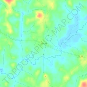
Name: Cooksville topographic map, elevation, terrain.

Location: Cooksville, Heard County, Georgia, United States (33.21929 -85.01772 33.25929 -84.97772)

Average elevation: 212 m

Minimum elevation: 194 m

Maximum elevation: 256 m

Other topographic maps

Click on a map to view its topography, its elevation and its terrain.

Corinth

United States > Georgia > Heard County

Average elevation: 233 m

Centralhatchee

United States > Georgia > Heard County

Average elevation: 252 m

Ephesus

United States > Georgia > Heard County

Average elevation: 360 m

Franklin

United States > Georgia > Heard County

Average elevation: 223 m

Gear up for your next adventure:

🥾Mountain Trail Shoes - High-traction shoes for mountain trails
🛁Quick-Dry Microfiber Towel - Space-saving towel that dries rapidly on the move
🎒Hiking Daypack - Lightweight and durable backpacks for day trips and excursions
🔭Compact Binoculars - Lightweight optics for scouting trails and wildlife
🩹Moleskin Blister Pads - Direct protection for painful foot pressure points

As an Amazon Associate, this site earns from qualifying purchases at no extra cost to you.