
Penk topographic map
Click on the map to display elevation.
About this map
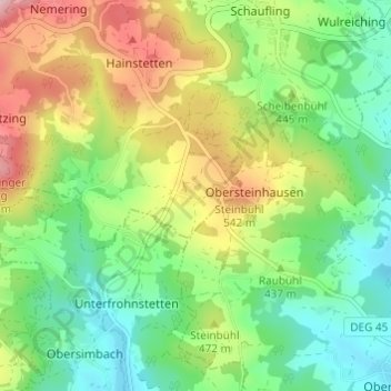
Name: Penk topographic map, elevation, terrain.
Average elevation: 437 m
Minimum elevation: 326 m
Maximum elevation: 625 m
Other topographic maps
Click on a map to view its topography, its elevation and its terrain.
Deggendorf
Deutschland > Bayern > Landkreis Deggendorf
In Deggendorf war der südwestliche Startpunkt des Böhmwegs, eines bedeutenden alten Handelswegs, der die bayerische Donau durch den Bayerischen Wald mit Böhmen verband. Außerdem lag Deggendorf an der römischen Militärgrenze Donaulimes entlang der bayerischen Donau. Das heutige Stadtzentrum liegt…
Average elevation: 449 m
Plattling
Deutschland > Bayern > Landkreis Deggendorf
Bis 1379 soll Plattling am östlichen Isarufer gelegen haben, wovon auch heute noch die aus dem 12. Jahrhundert stammende Pfarrkirche St. Jakob zeugt. Wegen ständiger Überschwemmungen wurde der Ort damals auf Anordnung von Herzog Albrecht I. verlegt. Die entsprechende Urkunde vom 10. November 1379 lässt…
Average elevation: 321 m
Rechter Plattlinger Mühlbach
Deutschland > Bayern > Landkreis Deggendorf > Plattling
Average elevation: 319 m
Grafling
Deutschland > Bayern > Landkreis Deggendorf
Zu den geografischen Besonderheiten zählen die großen Höhenunterschiede. Während der Hauptort 546 m hoch liegt, beträgt der Höhenmeter im Ortsteil Klein- und Großtiefenbach nur 330 m, der Gemeindeteil Rohrmünz liegt aber 730 m hoch. Hochoberndorf befindet sich auf 775 m. Dadurch ergeben sich innerhalb…
Average elevation: 674 m
94469
Deutschland > Bayern > Landkreis Deggendorf > Deggendorf > Oberkandelbach > Thannberg
Average elevation: 462 m
Niederalteich
Deutschland > Bayern > Landkreis Deggendorf
Der Ort entstand im Laufe der Zeit aus dem Kloster Niederaltaich der Benediktiner, das im Jahre 731 oder 741 von Herzog Odilo von Bayern gegründet worden war. Die Mönche kamen aus dem Inselkloster Reichenau im Bodensee. Sie wählten ein unbewohntes Gebiet im Mündungsgebiet der Isar und bauten auf einer…
Average elevation: 315 m