Geolocate

Auerbach topographic map

Click on the map to display elevation.

About this map

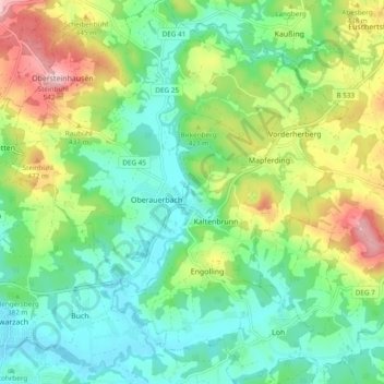
Name: Auerbach topographic map, elevation, terrain.

Location: Auerbach, Landkreis Deggendorf, Bavaria, 94530, Germany (48.77481 13.05496 48.83764 13.13793)

Average elevation: 386 m

Minimum elevation: 311 m

Maximum elevation: 541 m

Gear up for your next adventure:

🌬️Windproof Camp Stove - Efficient cooking even on exposed mountain peaks
🥫Freeze-Dried Meals - Lightweight, high-calorie nutrition for multi-day treks
🛶Kayak Accessories - Essential gear for safe and fun kayaking adventures
🥾Trail Running Shoes - Lightweight and durable shoes for trail running
🔦LED Flashlight - Powerful and long-lasting flashlight for camping and emergencies

As an Amazon Associate, this site earns from qualifying purchases at no extra cost to you.