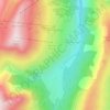
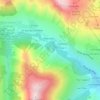
Cluny topographic map
Click on the map to display elevation.
About this map

Name: Cluny topographic map, elevation, terrain.
Average elevation: 1,665 m
Minimum elevation: 1,375 m
Maximum elevation: 2,063 m
Other topographic maps
Click on a map to view its topography, its elevation and its terrain.

En-bas du Cimetière
France > Auvergne-Rhône-Alpes > Savoie > Saint-Sorlin-d'Arves
Average elevation: 1,787 m
Entre les Rieux
France > Auvergne-Rhône-Alpes > Savoie > Saint-Sorlin-d'Arves
Average elevation: 1,905 m
Refuge de l'Étendard
France > Auvergne-Rhône-Alpes > Savoie > Saint-Sorlin-d'Arves
Average elevation: 2,437 m
Les Teppes du Rieu-Froid
France > Auvergne-Rhône-Alpes > Savoie > Saint-Sorlin-d'Arves
Average elevation: 1,843 m

Pic de l'Étendard
France > Auvergne-Rhône-Alpes > Savoie > Saint-Sorlin-d'Arves
Average elevation: 2,930 m

Le Champ du Nez
France > Auvergne-Rhône-Alpes > Savoie > Saint-Sorlin-d'Arves
Average elevation: 1,938 m
Glacier de Saint-Sorlin
France > Auvergne-Rhône-Alpes > Savoie > Saint-Sorlin-d'Arves
Average elevation: 2,912 m


Bachat
France > Auvergne-Rhône-Alpes > Savoie > Saint-Sorlin-d'Arves > Malcrozet
Average elevation: 1,697 m

Arête de la Lausaz
France > Auvergne-Rhône-Alpes > Savoie > Saint-Sorlin-d'Arves
Average elevation: 1,914 m