Geolocate

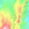
Turin topographic map

Click on the map to display elevation.

About this map

Name: Turin topographic map, elevation, terrain.

Location: Turin, Saint-Sorlin-d'Arves, Saint-Jean-de-Maurienne, Savoie, Auvergne-Rhône-Alpes, France métropolitaine, 73530, France (45.20358 6.19631 45.24358 6.23631)

Average elevation: 1,971 m

Minimum elevation: 1,466 m

Maximum elevation: 2,504 m

Other topographic maps

Click on a map to view its topography, its elevation and its terrain.
Cluny

France > Auvergne-Rhône-Alpes > Savoie > Saint-Sorlin-d'Arves

Average elevation: 1,665 m

Gear up for your next adventure:

🔦LED Headlamp - Hands-free lighting for early morning starts or late finishes
💧Collapsible Water Bottle - Space-saving water bottle for outdoor activities
🎒Hiking Daypack - Lightweight and durable backpacks for day trips and excursions
🚲MTB Frame Bag - Carry tools and maps directly on your bicycle frame
🥽Outdoor Goggles - Protective eyewear for outdoor activities

As an Amazon Associate, this site earns from qualifying purchases at no extra cost to you.