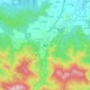
Savadkuh County topographic map
Click on the map to display elevation.
About this map

Name: Savadkuh County topographic map, elevation, terrain.
Location: Savadkuh County, Mazandaran Province, Iran (35.81830 52.64543 36.34480 53.25366)
Average elevation: 1,528 m
Minimum elevation: 74 m
Maximum elevation: 3,689 m
Other topographic maps
Click on a map to view its topography, its elevation and its terrain.


Damavand
Iran > Mazandaran Province > Amol County > دهستان لاریجان سفلی
Mount Damavand (Persian: دماوند [dæmɒːˈvænd] English: /dɔːmoʊˈvænd/ Da-moh-VAND) is a dormant stratovolcano in Iran. It is the highest peak in Iran and Western Asia, the highest volcano in Asia, and the third highest volcano in the Eastern Hemisphere (after Mount Kilimanjaro and Mount Elbrus),…
Average elevation: 4,949 m


Alborz Dam
Iran > Mazandaran Province > North Savadkuh County > دهستان لفور > لفورک
Average elevation: 324 m


Shirgah
Iran > Mazandaran Province > North Savadkuh County > دهستان شرق وغرب شیرگاه
Average elevation: 408 m



Filband
Iran > Mazandaran Province > Babol County > دهستان فیروزجاه
This village is located at an altitude of about 2,300 metres above sea level. Filband on the eastern side of Mazandaran is known as the roof of the province.
Average elevation: 1,923 m


Fereydunkenar
Iran > Mazandaran Province > Fereydunkenar County > دهستان باریک رود شمالی
Average elevation: -25 m


Kordichal
Iran > Mazandaran Province > Kelardasht County > دهستان کلاردشت شرقی
Average elevation: 1,235 m


Alborz Mountains
Iran > Mazandaran Province > Amol County > دهستان لاریجان سفلی
While the southern slopes of the Alborz Mountains are usually semiarid or arid, with irregular and low precipitation, the northern slopes of the range are usually humid, especially in the western parts of the Central Alborz. The Alborz is the easternmost extent of many European plant species. In the southern…
Average elevation: 4,934 m
Damavand
Iran > Mazandaran Province > Amol County > دهستان لاریجان سفلی
Mount Damavand (Persian: دماوند [dæmɒːvænd] ) is a dormant stratovolcano and is the highest peak in Iran and Western Asia, the highest volcano in Asia, and the 3rd highest volcano in the Eastern Hemisphere (after Mount Kilimanjaro and Mount Elbrus), at an elevation of 5,609 metres (18,402 ft).…
Average elevation: 4,949 m


Kelardasht
Iran > Mazandaran Province > Kelardasht County > دهستان کلاردشت غربی
Average elevation: 1,473 m

Filband
Iran > Mazandaran Province > Babol County > دهستان فیروزجاه
This village is located at an altitude of about 2,300 metres above sea level. Filband on the eastern side of Mazandaran is known as the roof of the province.
Average elevation: 1,923 m

Namak Abrud
Iran > Mazandaran Province > Chalus County > دهستان کلارستاق غربی
Average elevation: 158 m
Alborz Mountains
Iran > Mazandaran Province > Amol County > دهستان لاریجان سفلی
While the southern slopes of the Alborz Mountains are usually semiarid or arid, with irregular and low precipitation, the northern slopes of the range are usually humid, especially in the western parts of the Central Alborz. The Alborz is the easternmost extent of many European plant species. In the southern…
Average elevation: 4,934 m
Damavand
Iran > Mazandaran Province > Amol County > دهستان لاریجان سفلی
Mount Damavand (Persian: دماوند [dæmɒːˈvænd] English: /dɔːmoʊˈvænd/ Da-moh-VAND) is a dormant stratovolcano in Iran. It is the highest peak in Iran and Western Asia, the highest volcano in Asia, and the 3rd highest volcano in the Eastern Hemisphere (after Mount Kilimanjaro and Mount Elbrus), at…
Average elevation: 4,949 m




Doab Garrison
Iran > Mazandaran Province > Savadkuh County > دهستان راستوپی
Average elevation: 1,231 m

Damavand
Iran > Mazandaran Province > Amol County > دهستان لاریجان سفلی
Mount Damavand (Persian: دماوند [dæmɒːvænd] ) is a dormant stratovolcano and is the highest peak in Iran and Western Asia, the highest volcano in Asia, and the 3rd highest volcano in the Eastern Hemisphere (after Mount Kilimanjaro and Mount Elbrus), at an elevation of 5,609 metres (18,402 ft).…
Average elevation: 4,949 m




Avijdan
Iran > Mazandaran Province > Kelardasht County > دهستان کلاردشت غربی
Average elevation: 1,110 m

محله ۵
Iran > Mazandaran Province > Chalus County > دهستان کلارستاق غربی > Mesedeh
Average elevation: 231 m




Kelardasht
Iran > Mazandaran Province > Kelardasht County > دهستان کلاردشت غربی
Average elevation: 1,473 m