
Clanfield topographic map
Click on the map to display elevation.
About this map
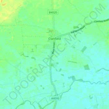
Name: Clanfield topographic map, elevation, terrain.
Average elevation: 71 m
Minimum elevation: 65 m
Maximum elevation: 84 m
Other topographic maps
Click on a map to view its topography, its elevation and its terrain.
Ledwell
United Kingdom > England > Oxfordshire > West Oxfordshire > Sandford St. Martin
Average elevation: 142 m
Eynsham Mill
United Kingdom > England > Oxfordshire > West Oxfordshire > Eynsham
Average elevation: 71 m
Shipton-under-Wychwood
United Kingdom > England > Oxfordshire > West Oxfordshire
Average elevation: 131 m
Great Park
United Kingdom > England > Oxfordshire > West Oxfordshire > Long Hanborough
Average elevation: 94 m
Upper Milton
United Kingdom > England > Oxfordshire > West Oxfordshire > Milton-under-Wychwood
Average elevation: 153 m